Floods
The Brussels Region is exposed to the risk of flooding, which is nothing new. The word "Brussel" comes in part from the word "broek", meaning marsh...
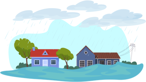
Heavy rainfall and unsuitable urbanisation are not a good combination. In the Brussels Region, rainwater run-off into sewers and the saturation of these sewers is the main cause of flood risk. Increased concreting of Brussels soil is preventing rainwater from infiltrating properly during downpours. The water then flows into the region's valleys, which are historically wet and naturally prone to flooding. These wet areas have been progressively urbanised and are now home to a growing number of buildings, infrastructures and activities. As a result, when there is very heavy rain, the streets turn into streams, the sewer network become saturated and backs up into the subsoil, which ends up flooding. Fortunately, thanks to the presence of the canal that receives excess water from the Senne and the drainage system, as well as the presence of numerous underground storm basins, the Brussels Region is largely spared from catastrophic flooding. Nevertheless, violent storms and heavy rainfall all too often cause a great deal of damage and inconvenience.
The majority of the flooding in our region is therefore caused by precipitation (rainwater run-off) and the clogging of sewers (causing water to back up into the subsoil), known as pluvial flooding. The problem is generally more frequent during the summer months. Water from short periods of torrential rain is drained into a sewer network that is not designed to carry away such volumes of water. The sewer network is then overloaded, causing mixed water (waste water and clean water) to overflow into the subsoil and sometimes even onto the surface. To a lesser extent, there are also instances of fluvial flooding, i.e. the overflowing of rivers: usually in winter (but let's not forget the summer of 2021!), rivers can break their banks in the event of prolonged rainfall.
Brussels Water Management Plan
We can't stop the rain from falling. However, if governments, organisations, associations, businesses and individuals work together, we can try to prevent or reduce the damage caused by flooding. The Brussels Water Management Plan (Plan de gestion de l'eau de Bruxelles – PGE) sets out a number of government measures to combat flooding and minimise the damage it causes. The new PGE for the period 2022-2027 was approved on 22 June 2023.
The main objective of the Plan is to make our city more resilient in the face of climate change, and includes measures to prevent and manage floods and droughts. One of the key elements of this new plan is the "Integrated Rainwater Management" strategy, which is to be applied as far as possible throughout the whole of Brussels. The plan also sets out flood risk prevention and management measures to be implemented by all. Without the support of residents, the plan cannot be effective.
"Faire face aux inondations" (Dealing with flooding): the right thing to do before, during and after a flood. This Brussels Environment brochure aims to inform all citizens, whether they live or work in Brussels, of the need to act correctly if there is a flood, before, during and after the event. The booklet includes a number of measures to protect your home and belongings from flooding. You can access this brochure from the bottom of the page, in the Useful links section.
Flood maps for the Brussels Region
Brussels Environment has also produced interactive flood maps. Flood hazard maps show the location of areas where flooding may occur, as well as the intensity (low, medium or high) and frequency of flooding. On the map, you can search for an address and zoom in and out.
Flood risk maps show the potential negative impacts of flooding: danger zones for people, economic activity, industrial facilities (which can cause accidental pollution due to flooding), drinking water catchment areas, Natura 2000 zones and cultural heritage. These are "risk factors" indicated on the map when they are located in the area prone to flooding.
These maps have been produced due to a European directive obliging our Region to do so. The purpose of the maps is to show the location of flood-prone areas, so as to determine the prevention and protection measures to be taken to reduce both the frequency and the impact of flooding. You'll find links to these maps at the bottom of the page, in the Useful links section.
Useful links
Learn more about how you can prepare in the event of a flood:
Emergency calls


Follow us!